
Coral Gables Neighbor Records
The most reliable block search separates land from people. The county GIS shows which parcels are actually adjacent. The tax roll names assessed owners and their mailing addresses. A public voter extract may add nonexempt registrations, while historic reverse directories place listed household heads and businesses in address order. Zoning, permits, aerials, and civic groups add context. None of these sources alone proves who is home today.
| Source | What It Shows About a Block | Access |
|---|---|---|
| County parcel GIS | Adjoining parcel polygons, folios, map and aerial context | Free click and browse |
| Miami-Dade property roll | Owner, mailing address, situs, exemptions, and sales per parcel | Free address, owner, subdivision, or folio search |
| Florida voter public extract | Nonexempt registrations and precinct data at nearby addresses | Request and extract rules apply |
| Historic reverse directory | Listed household heads and businesses in address order | Library or archive |
| Zoning and permit layers | Land use, projects, construction, and dated owner or applicant clues | City platforms or records request |
| Neighborhood groups | Public officers, contact points, projects, and events | Public city or group pages; member roster usually private |
A same-address owner mailing address and a homestead exemption are evidence consistent with owner occupancy. They are not a household roster. An out-of-area mailing address may point to an absentee owner or entity, but it does not identify the people using the site. For Coral Gables neighbors, mark every name as owner, voter, directory listing, applicant, or public group officer. That label makes the strength of the connection clear.
Build a Coral Gables Folio List
Start with the Miami-Dade Property Search. Its main fields are Address, Owner Name, Subdivision Name, and Folio, with a separate suite box for units. Search the known address, open the parcel, and copy its folio. Then use the map to identify touching lots. A folio is the county's parcel identifier, while a parcel is the mapped unit of land assessed as one record.
- Normalize the starting address and select the exact parcel, including any unit or suite.
- Zoom to the parcel polygon and switch on aerial imagery for roads, water, and common land.
- Click each touching polygon one at a time and record its folio before recording any owner name.
- Open every parcel card and label the situs, owner mailing address, exemption, and sale reference.
- Remove road, water, utility, and common tracts before building the block list.
Condominiums need extra care because one street number can hold many units. Similarly numbered roads and locally named Spanish or Mediterranean streets can also create bad matches. The folio keeps the search anchored to the selected parcel rather than a loose text match.
Note: Record the roll year and access date because the Property Appraiser warns that assessment data is continuously edited.
Map Coral Gables Neighbors
The adjacent-parcel method is visual. Select the subject polygon, then walk outward through the parcels that touch it. Use an aerial view so a canal, street, golf-course tract, or association common area is not counted as a household lot. The county map supplies the ownership authority. Coral Gables' planning platform adds zoning and future-land-use context.
- Locate the subject in Miami-Dade Property Search and confirm its boundary against the aerial image.
- Open each adjacent folio and record the owner as displayed, including a trust or company name.
- Compare the situs with the owner mailing address and note any homestead exemption without treating it as proof of every occupant.
- Use the full Coral Gables street directory when the task expands beyond the immediate block.
Trust and company ownership is common in high-value property. Do not turn an entity name into a resident name without reviewing official filings and the recorded instrument. Keep corporate officers, trustees, owners, voters, and permit applicants in separate columns. Their roles are not interchangeable.
Coral Gables Block Layers
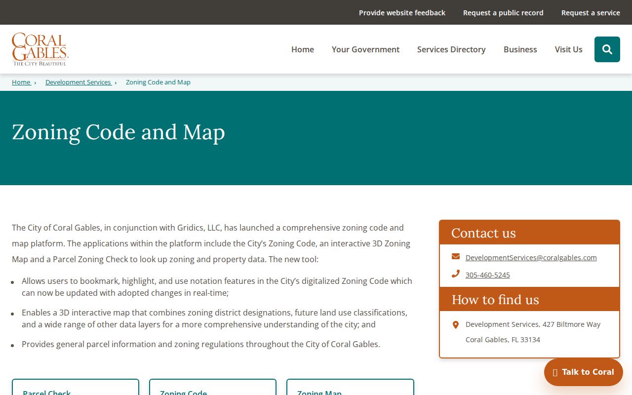
The Coral Gables zoning and parcel tools include a searchable digital code, an interactive 3D zoning map, and Parcel Zoning Check. An address or parcel selection can reveal the zoning district, future land use, and general parcel data. This layer confirms whether a lot sits within city jurisdiction and helps distinguish a home site from civic, business, university, or shared property.
The city tool captured below shows the official planning entry point for block research.
Permits and code files can add an owner, applicant, contractor, site, work description, hearing, or compliance date. They describe a project or case, not a resident roster. Compare each dated name with the parcel roll that was current at the time.
Coral Gables Neighborhood Layers
North Gables, Central Gables, South Gables, Riviera, the University area, Golden Triangle, Cocoplum, Gables Estates, Old Cutler and Biscayne Bay sections, Gables by the Sea, and MacFarlane are useful local labels. They are not one kind of boundary. Some are descriptive areas, some are gated associations, and none should be treated as the same thing as a ZIP code or parcel line.
The Neighborhood Renaissance Program provides public city context for projects and contacts. Associations in Cocoplum, Gables Estates, and Gables by the Sea may publish board or contact information, while member directories remain private unless the group grants access. Public ties can also come from the Chamber of Commerce, Garden Club, preservation groups, University of Miami resources, and houses of worship. Affiliation is not proof of residence.
| Community source | Appropriate public use | Boundary |
|---|---|---|
| City neighborhood program | Projects, public contacts, and meeting context | Not a household directory |
| Association public page | Officers, general contact, and public events | Private member rosters require permission |
| Civic or preservation group | Published leaders, programs, and historic newsletters | Membership does not prove a home address |
| University or congregation | Public archives and institutional contacts | Affiliation may be temporary or nonresidential |
Coral Gables Voter Block Data
Florida registration and voting history are public subject to exemptions. A lawful statewide extract may contain a nonexempt voter's name, residence or mailing address, party, registration date and status, precinct or district, and elections in which the person participated. Ballot choices are never public. The extract is generated monthly, so county updates can appear sooner.
The one-person status form is not a block browser. It requires first name, last name, date of birth, and county. For block work, use the Florida voter extract request under its stated terms, or contact Miami-Dade Elections. Remove protected addresses and never infer that a missing voter means an empty home. Not all residents register, and inactive status does not prove a move on a specific day.
Historic Coral Gables Neighbors
A reverse, or criss-cross, directory arranges listed people and businesses by street and number instead of surname. It is the right historical tool for seeing who appeared around one address. Verified Coral Gables checkpoints include a standalone 1934 directory and the 1939 Greater Miami Polk volume. Later Miami and suburban titles can also cover the city, so a city-name-only catalog search is too narrow.
Read the address section first, copy adjacent listings, then confirm each name in alphabetical pages. A directory can omit people who declined, moved before publication, used another spelling, or were not surveyed. For a deeper block history, pair the list with public census schedules through 1950, the 1924 Sanborn maps, and Coral Gables newspapers from 1941 through 1977.
Note: Historic maps and directories supply dated snapshots, so never merge nearby names from different years into a single household list.
Coral Gables Parcels at Scale
The July 2025 preliminary assessment report counted 19,998 Coral Gables real-estate parcels, including 10,827 single-family parcels and 5,641 condominiums, with about $40.7 billion in just value. Those figures explain why a block method is more reliable than trying to browse the entire city. They also show why one street number may represent many units or ownership records.
Use the numbers as dated scale, not permanent totals. A small radius still demands parcel-by-parcel checks. The city stretches from older northern and central districts to waterfront and gated southern areas, so lot form, access, and community sources vary sharply from one block to another.
Choose Official Coral Gables Records
Commercial neighbor tools combine public and purchased data. They can merge same-name people, preserve old addresses, and overlook protected changes. Official sources are narrower, but each identifies its keeper, record date, and correction path. Use the parcel roll for ownership, the voter custodian for registration, the city for permits, and a library or archive for historical listings.
| Source type | Strength | Limit |
|---|---|---|
| Official roll or filing | Named custodian, dated record, defined fields | Answers only the record's purpose |
| Library or archive source | Historical context and dated editions | May omit people or require an appointment |
| Commercial compilation | Broad hints across many sources | May be stale, merged, or hard to correct |
Protect Coral Gables Neighbors
Tax records do not enumerate renters, children, roommates, or every family member. Utility customer and delivery data should not be assumed public, and federal law restricts personal motor-vehicle information. Florida also withholds specified voter application fields and protects qualifying home addresses under occupational exemptions and the Attorney General's Address Confidentiality Program.
When a source omits a person or address, respect the boundary. A missing name is not an invitation to seek private rosters or evade a protection. Corrections belong with the actual custodian. Public group contacts can answer civic questions without exposing a membership list.
Lawful use. Use neighbor records for civic curiosity, reconnection, and personal safety awareness. Never watch, threaten, harass, or intimidate another person.